A viewshed shows us the area that can be seen from a given point or points. Viewsheds are used in a variety of commercial applications including; positioning cell phone towers, selecting viewing points along roads, and selecting sites for homes. They are also used in natural resource applications for positioning spotting towers and for analysis of prey behavior as prey will avoid areas where they cannot see the predators hiding behind hills waiting to jump out and eat them!
Viewsheds are created using a DEM. The figure below shows how if you were standing on the side of a mountain, you would only be able to see areas that are facing toward you and not blocked by other objects. The total area that you can view is called the "viewshed".
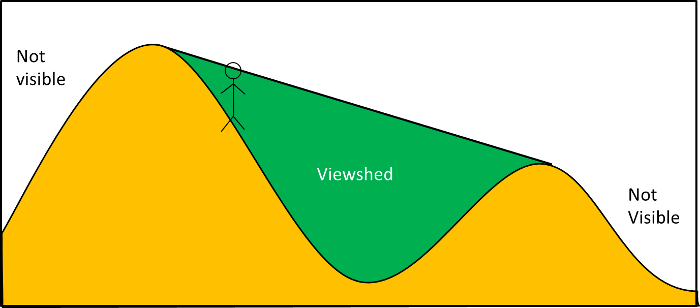
Note that the view shed will extend to the full extent of the DEM, we've just provided two hills in the figure above.
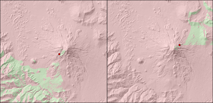
Below are the viewsheds created by points on different sides of Mount Shasta in Northern California. These viewsheds were created assuming the viewer was 30 meters above the ground at the point shown in red. First time viewshed creators are often surprised at how little we can see in our viewshed. This is because most areas are fairly rough and unless we are way above the ground, our view is blocked. The point on the right is blocked by a number of features on the mountain really limiting what can be seen from that position.
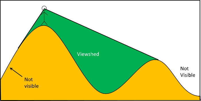
You might expect that you could see much more from the top of a mountain and, typically, you'd be right. The diagram below shows that you can now see both sides of the mountain. However, our view is blocked to the left where the side of the mountain blocks our view of the bottom of the mountain.
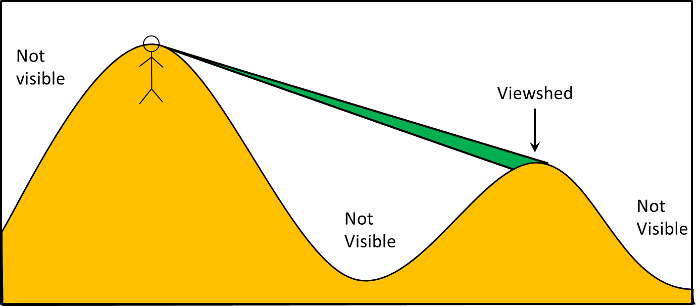
This becomes much worst with the default settings in ArcGIS. ArcGIS assumes there is a height of 0 for the viewing height. The figure below shows that when the height is 0, it's like we've been buried up to our eyes. Our viewing position is right on top of the ground. This means that much more of the terrain is hidden from us than normally would be.
The image on the left below is with the default settings in ArcGIS or with a viewing height of 0. The one on the right was created with a viewing height of 10meters. Notice that much more of the surrounding area is visible including pixels directly below the viewing position.

To fix the viewing height in ArcGIS you must add an attribute labeled "OFFSETA" (all capitals) and set this to the height above the ground you want your viewing position to be. This is an unusually way to set a parameter in ArcGIS (or any GIS application) so you'll want to make a note of it.
© Copyright 2018 HSU - All rights reserved.